Wild Atlantic Way eSIM 2026: Connected on Ireland's Coast
Connectivity on the Wild Atlantic Way
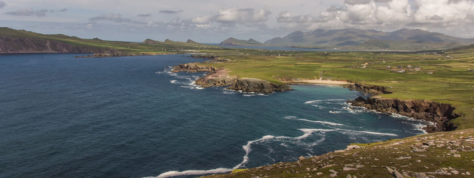
The Wild Atlantic Way is one of the world's great road trips, a spectacular 2,500-kilometer coastal route running the entire western seaboard of Ireland from Donegal in the north down through Connemara, Galway, the Burren, the Cliffs of Moher, Kerry, and west Cork. It is wild, beautiful, and sparsely populated, which is precisely why it presents a genuine connectivity challenge: the route passes through the well-covered towns and also through some of the most remote rural areas in Ireland, with thin or absent signal on the wilder stretches. This guide covers exactly what to expect from your eSIM along the Wild Atlantic Way and how to stay connected and oriented through a coastal drive.
The route rewards preparation. Get your connectivity setup right, with a strong network and thorough offline maps, and you can drive this magnificent coast confidently. Assume blanket coverage and the wilder stretches will catch you out.
The coverage reality: mixed, with genuine gaps
Coverage along the Wild Atlantic Way is mixed, reflecting the route's passage through both towns and wilderness. The towns and larger villages along the way, Donegal town, Westport, Galway, Dingle, Kenmare, and others, have good coverage, and the busier sections near them are usually fine. But between them, on the remote coastal and mountain roads of Connemara, the Donegal coast, the Kerry and west Cork peninsulas, and the wildest stretches, the signal thins or disappears, sometimes for a good while.
This is the important reality for the route: good coverage in the towns and busier sections, thin or absent signal on the wild stretches in between. It is partly about choosing a strong network, Vodafone and Three reach furthest, but even they cannot cover the emptiest Atlantic areas. Plan for thin or no signal on the remote stretches, with coverage in the towns, and you will be properly prepared for a route that is spectacular precisely because so much of it runs through genuinely wild, sparsely populated country where the network does not fully reach.
Why a strong network and offline maps matter here
For the Wild Atlantic Way, two preparations are essential: a strong network and thorough offline maps. Choose an Ireland eSIM on Vodafone or Three, the networks with the best rural reach, to maximize the proportion of the route where you have signal in the covered sections. Even so, accept that the wildest stretches will leave you with little or no signal, since no network fully covers them.
That is why offline maps are not optional on this route. Before you drive, download comprehensive offline maps for the entire Wild Atlantic Way and the areas around any detours, and test them in airplane mode to confirm they work without signal. With offline maps, you can navigate the remote coastal and mountain roads, find your accommodation, and stay oriented even where there is no signal, which is much of the wilder route. Without them, a wrong turn on a remote peninsula road with no signal to re-route can leave you lost in genuinely beautiful but empty country. The combination of a Vodafone or Three eSIM for the covered sections and comprehensive offline maps for the gaps is the essential setup for the Wild Atlantic Way.
Highlights and the remote stretches
The Wild Atlantic Way strings together many of Ireland's most famous sights, and knowing the coverage pattern helps you plan. The busier, more touristed highlights, the Cliffs of Moher, the area around Galway, the main towns, generally have coverage, so you can share photos and check details there. The wilder, more remote sections, the Connemara coast, the Sky Road, the remote Donegal peninsulas, the Beara and Iveragh peninsulas in the southwest, the more isolated beaches and headlands, are where the signal thins, sometimes to nothing.
For these remote stretches, your offline maps carry you, and you should not rely on a live signal for navigation. The driving itself on the wilder sections is on narrow, winding coastal and mountain roads, often single-track in places, so attention to the road matters as much as connectivity. Carry the practical essentials, fuel since stations are far apart in the remote areas, water, and warm layers, and let someone know your rough route if you are heading well off the beaten track. The remote stretches are the heart of the Wild Atlantic Way's appeal, wild and empty, and being beyond the network there is part of the experience, manageable with offline maps and sensible preparation.
Tips for a great Wild Atlantic Way drive
A few habits make the Wild Atlantic Way smooth. Download offline maps for the whole route and test them offline, as the foundation of your navigation. Cache music, podcasts, and any audio for the long remote drives where there is no signal to stream. Set photo and video backups to wifi-only at your accommodation, so a day of dramatic coastal photos does not try and fail to back up over a thin mobile signal. Plan fuel stops with the knowledge that stations are sparse in the remote west, and start each remote leg with a full tank.
Use your live eSIM data, on Vodafone or Three, in the towns and covered sections for checking conditions, finding accommodation and food, and sharing, and rely on offline maps for the wild stretches in between. Because the route is long, 2,500 kilometers end to end, most travelers drive a section rather than the whole thing, so plan offline maps for the portion you are tackling. With a strong-network eSIM, comprehensive offline maps, audio cached for the remote drives, and sensible preparation for the narrow roads and sparse fuel, the Wild Atlantic Way is one of the most rewarding drives in Europe, where being beyond the network on the wild stretches is part of the adventure rather than a problem.
The best eSIM for the Wild Atlantic Way
For a Wild Atlantic Way drive, the priorities are a strong network and thorough offline preparation. Choose an Ireland eSIM on Vodafone or Three, the networks with the best rural reach, accepting that even they will leave you with little signal on the wildest stretches. Size your data normally, but understand you will use little of it on the remote sections simply because there is no signal, so the network and offline maps matter more than the data amount.
Download comprehensive offline maps for your portion of the route before you go, test them in airplane mode, and treat them as your primary navigation on the wild stretches. Cache audio for the remote drives, set photo backups to wifi-only, and plan fuel stops for the sparse remote west. If your trip combines the Wild Atlantic Way with Northern Ireland, for instance continuing up the Causeway Coast, note that an Ireland plan covers only the Republic, so a Europe regional eSIM covering both the Republic and the UK is the choice for an all-island coastal trip. Install before you fly, set the eSIM as your data line, keep your home SIM for codes, and above all prepare those offline maps. Do that and the Wild Atlantic Way, for all its genuine connectivity challenges, becomes one of the most magnificent drives you can take. Ireland plans start from around $4, with a Vodafone or Three plan and offline maps the essential combination for this spectacular, wild coast.
A final word on Wild Atlantic Way connectivity
The Wild Atlantic Way asks more of a traveler's connectivity planning than a drive through populated, flat countryside, but the reward for that planning is the chance to experience one of Europe's most spectacular coastal routes properly equipped. The essentials bear repeating because they genuinely matter on this wild, sparsely populated coast: choose an eSIM on Vodafone or Three for the best coverage in the towns and covered sections, download comprehensive offline maps for your portion of the route and test them in airplane mode so your navigation works throughout the thin-signal stretches, cache audio for the long remote drives, set photo backups to wifi-only, and plan fuel stops for the sparse remote west.
Approached this way, the patchy coverage stops being a problem and becomes simply part of the character of the route. There is something genuinely valuable about driving a coast so wild that the mobile network does not fully reach it, a rare experience in modern Europe, and the Wild Atlantic Way offers it across hundreds of kilometers of dramatic Atlantic scenery. With the right preparation you can embrace that disconnection on the wild stretches, navigating confidently on offline maps and enjoying the freedom of being beyond constant connectivity along one of the most beautiful coastlines anywhere. The route is not a place to fight the thin signal but to plan around it and then appreciate it, and a properly set up traveler, with a strong-network eSIM for the covered moments and thorough offline preparation for the rest, is free to do exactly that. If your trip continues into Northern Ireland along the Causeway Coast, a Europe regional eSIM covering both the Republic and the UK is the choice. Ireland plans start from around $4, and for the Wild Atlantic Way a Vodafone or Three plan plus comprehensive offline maps is the essential combination.
Plans for Ireland
Ireland eSIM plans
Prices in USD. Instant QR activation. Pick your data, land connected.
FAQ
Why a strong network and offline maps matter here?
For the Wild Atlantic Way, two preparations are essential: a strong network and thorough offline maps. Choose an Ireland eSIM on Vodafone or Three, the networks with the best rural reach, to maximize the proportion of the route where you have signal in the covered sections. Even so, accept that the wildest stretches will leave you with little or no signal, since no network fully covers them.
What coverage and network performance should travelers expect in Ireland?
Coverage along the Wild Atlantic Way is mixed, reflecting the route's passage through both towns and wilderness. The towns and larger villages along the way, Donegal town, Westport, Galway, Dingle, Kenmare, and others, have good coverage, and the busier sections near them are usually fine. But between them, on the remote coastal and mountain roads of Connemara, the Donegal coast, the Kerry and west Cork peninsulas, and the wildest stretches, the signal thins or disappears, sometimes for a good while.
Is a travel eSIM better than local SIM or roaming in Ireland?
For a Wild Atlantic Way drive, the priorities are a strong network and thorough offline preparation. Choose an Ireland eSIM on Vodafone or Three, the networks with the best rural reach, accepting that even they will leave you with little signal on the wildest stretches. Size your data normally, but understand you will use little of it on the remote sections simply because there is no signal, so the network and offline maps matter more than the data amount.
What is the connectivity picture in Ireland?
The Wild Atlantic Way is one of the world's great road trips, a spectacular 2,500-kilometer coastal route running the entire western seaboard of Ireland from Donegal in the north down through Connemara, Galway, the Burren, the Cliffs of Moher, Kerry, and west Cork. It is wild, beautiful, and sparsely populated, which is precisely why it presents a genuine connectivity challenge: the route passes through the well-covered towns and also through some of the most remote rural areas in Ireland, with thin or absent signal on the wilder stretches. This guide covers exactly what to expect from your eSIM along the Wild Atlantic Way and how to stay connected and oriented through a coastal drive.