Ring Road Iceland eSIM: Connectivity for the Full Loop
Why the ring road is its own connectivity story
The ring road, route one, is the highway that loops the entire island, roughly thirteen hundred kilometers connecting almost all of Iceland's populated places and major sights into one epic circular drive. It is the classic way to see the country, usually over a week to ten days, and for connectivity it is a journey through both Icelands: the well covered south and west, and the emptier, more remote east and parts of the north where the gaps grow longer. Understanding the coverage pattern along the full loop is essential for planning a ring road trip, because while you will have signal for much of it, you will hit genuine stretches of nothing, particularly in the sparsely populated east, and the highland interior the road skirts is entirely offline. This guide walks the loop and tells you where you stay connected and where to prepare for the gaps, so a ring road trip never leaves you stranded without maps in the emptier reaches of the island.
The well covered stretches: south, west and around the towns
For much of its length, the ring road is well covered, because it strings together the populated places. The southern and western portions, from Reykjavik around through the south coast and up the west, are the best served, following the more populated lowlands and major tourist routes. Around each town on the loop, Borgarnes in the west, Akureyri in the north, Egilsstadir in the east, Hofn in the southeast, Vik and Selfoss in the south, coverage is strong, and the stretches between nearby settlements are generally covered. So for a large share of the ring road drive, especially the southern and western halves and the approaches to every town, you will have signal for navigation, calls and sharing the spectacular scenery. The towns themselves are reliable bases with full coverage. This means the ring road is far from an offline ordeal; for much of the loop you are connected, and the gaps, while real, are interspersed with long stretches of good coverage.
The emptier stretches: the east and the highland edges
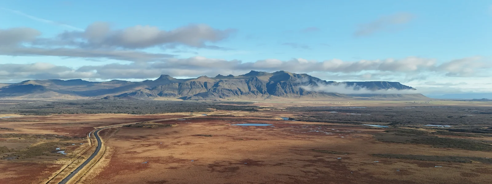
The gaps on the ring road cluster in the emptier regions. The eastern part of the loop, between the towns of the east and southeast, runs through some of Iceland's most sparsely populated country, with the longest stretches of weak or absent coverage along the main road, particularly through the remote eastern highlands and fjords the road threads. Parts of the north, away from Akureyri, also thin out. And everywhere the ring road runs near the interior, the highland country just inland is entirely offline. So as you drive the eastern third of the loop, expect coverage to come and go, with genuine gaps where you have no signal for a while. This is manageable with preparation but should not surprise you: the east is the wild, empty quarter of the ring road, beautiful and remote, and the network reflects the lack of population. Siminn tends to hold a signal longest in these stretches, which is why it is the recommended network for a full ring road trip.
Driving the loop and staying safe
A ring road trip is a driving trip, and the coverage gaps make a few safety habits essential. Download offline maps of the entire loop before you start, not segment by segment, because you cannot fetch a map in the empty east. Check the official Icelandic road conditions and weather sites every time you have signal, because conditions change fast and can close roads or make driving dangerous, especially outside summer. Note that the emergency number works on any available network, so even where your own network has no signal, an emergency call may connect via another. Keep your fuel topped up, because petrol stations are far apart in the emptier regions. Tell your accommodation your expected arrival so someone knows your movements. Choose Siminn or a multi network eSIM for the best chance of signal in the gaps. With these habits, the gaps become a normal part of a ring road adventure rather than a hazard, and the long offline stretches through empty landscapes become part of the trip's wild appeal rather than a worry.
A smart setup for the full ring road
For a ring road trip, the setup centers on preparation as much as on the eSIM itself. An EEA resident roams free across the whole loop; everyone else should buy an Iceland eSIM, ideally on Siminn or a multi network plan for the best reach in the empty east, sized at perhaps ten gigabytes for a week to ten days, remembering that the offline stretches keep your usage lower than you might expect. The essential companion to the eSIM is thorough offline preparation: the entire route downloaded as offline maps, accommodation details saved offline, the road and weather sites bookmarked to check at every signal, and emergency information noted. A connected itinerary might run clockwise or counterclockwise from Reykjavik, staying online through the well covered south and west, then preparing for the gaps as you reach the empty east, where you drive long offline stretches between the towns with everything cached in advance. The full ring road is one of the great drives on earth, through landscapes that empty out into genuine wilderness, and getting the connectivity right, which here means preparing properly for when you will have none, is part of doing the loop safely and savoring it fully.
Living the ring road, connected and offline by turns
The ring road is one of the world's great drives, and experiencing it well means embracing its rhythm of connection and disconnection rather than fighting it. Picture the loop unfolding over a week to ten days. You set out from Reykjavik, connected through the well covered south with its parade of waterfalls and the glacial lagoon, sharing the sights and navigating with ease. You round the southeast and begin the climb into the emptier east, where the towns grow farther apart and the coverage starts to come and go, the landscape opening into vast remote fjords and highlands where for long stretches your phone shows no signal and you simply drive through the silence, having downloaded your maps in advance and checked the road conditions at the last town. You reach Egilsstadir and the eastern settlements, back in coverage, then continue north toward Akureyri, the handsome capital of the north, fully connected, a place to rest and resupply. The northern stretch and the west bring you back through better covered country toward Reykjavik, completing the loop. Throughout, a Siminn or multi network eSIM gives you the best chance of catching signal in the gaps, while your offline maps and saved details carry you through the dead zones. The genius of the ring road is exactly this alternation: the connected stretches let you share and navigate freely, while the long offline passages through empty wilderness become the trip's most memorable hours, when it is just you, the car, and a landscape of glaciers and lava and endless sky with no notifications to break the spell. Prepared properly, the offline stretches are not a hazard but the heart of the adventure, and the ring road rewards the traveler who understands and plans for its two natures with one of the most complete and spectacular journeys available anywhere on earth.
Why the ring road rewards preparation
The full ring road is the trip that best demonstrates why Iceland rewards the prepared traveler above all, because over its thirteen hundred kilometers it passes through every kind of Icelandic connectivity, from the fully wired south to the genuinely empty east, and the traveler who has prepared for both glides through while the unprepared one gets caught out. The preparation that makes the loop work is not complicated but it is essential and specifically Icelandic. Before you set off, download the entire route as offline maps, the whole loop, not segment by segment, because you cannot fetch a map in the empty east where you most need it. Save every accommodation address and booking detail offline. Bookmark the official Icelandic road conditions and weather sites and make checking them a daily ritual at every signal, because conditions change fast and can close roads or turn driving dangerous, especially outside high summer. Choose Siminn or a multi network eSIM for the best chance of signal in the gaps. Keep your fuel tank generous because stations are far apart in the remote regions. Note that the emergency number works on any available network. With this preparation, the ring road's alternation between connected and offline becomes its great pleasure rather than a source of stress: the connected stretches let you navigate and share freely, and the long offline passages through empty wilderness, prepared for and unafraid, become the most memorable hours of the journey, when the landscape of glaciers, black deserts, fjords and endless sky has your full undivided attention with no signal to distract you. The ring road is one of the finest drives on earth precisely because it takes you through real wilderness, and the traveler who prepares for the offline stretches rather than being surprised by them gets to savor that wildness safely and fully, which is the whole reward of doing the loop right.
Plans for Iceland
Iceland eSIM plans
Prices in USD. Instant QR activation. Pick your data, land connected.
FAQ
How should travelers set up and activate an eSIM for Iceland?
For a ring road trip, the setup centers on preparation as much as on the eSIM itself. An EEA resident roams free across the whole loop; everyone else should buy an Iceland eSIM, ideally on Siminn or a multi network plan for the best reach in the empty east, sized at perhaps ten gigabytes for a week to ten days, remembering that the offline stretches keep your usage lower than you might expect. The essential companion to the eSIM is thorough offline preparation: the entire route downloaded as offline maps, accommodation details saved offline, the road and weather sites bookmarked to check at every signal, and emergency information noted.
What should travelers prepare before entering low-coverage areas in Iceland?
The ring road is one of the world's great drives, and experiencing it well means embracing its rhythm of connection and disconnection rather than fighting it. Picture the loop unfolding over a week to ten days. You set out from Reykjavik, connected through the well covered south with its parade of waterfalls and the glacial lagoon, sharing the sights and navigating with ease.
What should travelers know about the emptier stretches: the east and the highland edges in Iceland?
The gaps on the ring road cluster in the emptier regions. The eastern part of the loop, between the towns of the east and southeast, runs through some of Iceland's most sparsely populated country, with the longest stretches of weak or absent coverage along the main road, particularly through the remote eastern highlands and fjords the road threads. Parts of the north, away from Akureyri, also thin out. And everywhere the ring road runs near the interior, the highland country just inland is entirely offline. So as you drive the eastern third of the loop, expect coverage to come and go, with genuine gaps where you have no signal for a while.
What should travelers know about driving the loop and staying safe in Iceland?
A ring road trip is a driving trip, and the coverage gaps make a few safety habits essential. Download offline maps of the entire loop before you start, not segment by segment, because you cannot fetch a map in the empty east. Check the official Icelandic road conditions and weather sites every time you have signal, because conditions change fast and can close roads or make driving dangerous, especially outside summer. Note that the emergency number works on any available network, so even where your own network has no signal, an emergency call may connect via another. Keep your fuel topped up, because petrol stations are far apart in the emptier regions.