Norwegian Fjords eSIM: Staying Connected in Fjord Country
Why the fjords are the heart of a Norway trip
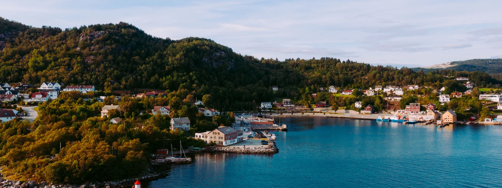
The fjords are the reason most people come to Norway, the deep blue arms of the sea reaching far inland between towering cliffs and snow capped peaks, dotted with waterfalls, orchards and tiny waterside villages. The classic fjord country of the west, anchored by Bergen and reaching out to the great Sognefjord, the Hardangerfjord, the Geirangerfjord and the Nærøyfjord, is among the most beautiful landscapes on earth, and exploring it means a mix of driving spectacular roads, sailing on fjord ferries and the famous scenic boat trips, riding dramatic railways, and venturing onto mountain passes and trails. This is also where connectivity becomes a real planning factor, because while the fjordside communities and main roads are well covered, the high country above them, the long tunnels through the mountains, and the wilder corners can lose signal. This regional satellite covers fjord country in detail, with the reassuring theme that the populated fjords and main routes keep you connected far better than the dramatic terrain suggests, while the high passes, the long tunnels and the remote trails are where you prepare to be offline.
Bergen and the fjordside towns
Bergen, the gateway to the fjords, is a well connected city with fast, reliable coverage across its historic centre, its harbour and its surrounding hills, so you start your fjord adventure fully online. The fjordside towns and villages that anchor the region, Flam at the head of the Aurlandsfjord, Geiranger on its spectacular fjord, Balestrand, Ulvik and the rest, are generally well covered around their centres and waterfronts, because Norway has invested in connecting even its scattered communities. So a fjord trip that bases in the towns and follows the main fjordside roads keeps you connected for the great majority of the time, with strong signal for your bookings, your ferry times, your navigation and sharing the staggering scenery. The abundant wifi in hotels and on many of the tourist boats and trains further smooths the experience. The fjordside, in short, is the connected backbone of fjord country, and the dead zones only appear when you climb away from the water into the high country or thread through the longer tunnels.
Scenic drives, ferries and the famous railways
Exploring the fjords means moving through them, and each mode has its connectivity character. The scenic drives, the great roads that wind along the fjords and over the mountain passes between them, are well covered along the fjordside stretches but can lose signal as they climb high or pass through the many tunnels, so download offline maps before setting out and do not rely on live navigation through a long tunnel. The fjord ferries and the famous scenic boat trips, like the cruise through the narrow Nærøyfjord, generally have signal as they hug the inhabited fjordsides, though it can dip in the most enclosed or remote stretches. The celebrated railways, above all the Flam Railway and the Bergen Line over the high country, pass through stunning and sometimes remote terrain where signal comes and goes, particularly on the high mountain sections and in tunnels. For all of these, the pattern is the same: connected along the populated fjordsides, intermittent on the high passes and in the long tunnels, so prepare offline and enjoy the disconnection through the wildest scenery.
The mountains above the fjords
Above the fjords rise the high mountains and plateaus, and this is where fjord country's genuine dead zones live. The hiking trails that climb to the famous viewpoints like Trolltunga and Preikestolen, the high passes, and above all the vast Hardangervidda plateau between the eastern and western fjords, can have weak signal or none once you leave the inhabited valleys and climb into the high country. The popular hikes are busy and you are rarely truly alone, but you should not assume a live connection at a clifftop viewpoint or on a high trail, so download offline maps and trail information before you set out, tell someone your plans for the longer hikes, and favour Telenor or Telia for the broadest reach. The drama of the fjords comes precisely from the height of the mountains around them, and that height is what creates the coverage gaps, so treat any ascent from the fjordside into the high country as a move from the connected world into the wilderness, prepared accordingly, and let the disconnection be part of the grandeur.
The smart setup for fjord country
Pulling it together, a connected fjord trip comes down to preparation done before you leave the connected towns. Buy a generous Norway eSIM sized for heavy navigation, since fjord touring leans on maps for hours of spectacular driving, so lean toward ten gigabytes or more for a one to two week fjord trip, or an unlimited style plan. Favour an eSIM on Telenor or Telia if your route includes the high passes, the plateaus or remote trails. Download offline maps of your whole route, every scenic drive, every tunnel heavy stretch and every trail before you set out, because the high country and the long tunnels will not give you a connection to load them when you need them. Keep your home number alive for verification codes with its data roaming off, and if you are an EU or EEA resident remember your home plan may already cover Norway free through the EEA. Install and test the eSIM in a city before heading into the fjords, following the setup satellite. Do that and fjord country, the connected backbone of a Norway trip with its wild high country above, stays navigated, booked and connected along the fjordsides, with the high passes and tunnels handled by your offline maps, leaving you free to lose yourself in the waterfalls, the cliffs and the deep blue water of some of the planet's most beautiful landscapes.
A connected fjord itinerary, start to finish
To see how all of this works across a real trip, follow a connected fjord itinerary from arrival to departure. You arrive in Bergen with your eSIM already installed and tested, on Telenor for the wilderness reach, and offline maps of your whole fjord route downloaded before you left the city wifi. You explore Bergen on fast city coverage, then pick up a hire car or board the scenic train and boat for the fjord country. As you drive along the Sognefjord or the Hardangerfjord, you stay connected along the fjordside, your navigation working on the populated stretches, and when you thread through a long tunnel you rely on the offline map you saved, knowing the signal may drop inside. You take a fjord ferry or the famous Nærøyfjord cruise, connected as it hugs the inhabited shore. You drive up to a famous viewpoint like Trolltunga or over a high mountain pass, and as you climb into the high country the signal fades, so you navigate and check the trail on your downloaded offline maps, having told someone your hiking plans. Back down in the fjordside towns, your connection returns for bookings, photos and calls home. Throughout, if you are an EU or EEA resident you may simply be roaming free thanks to the EEA, and if not, your Telenor eSIM carries you with your home number kept alive for codes, its data roaming off. That single worked example captures the theme of this satellite: the fjordsides and towns are the connected backbone, the high passes and long tunnels are handled by offline maps, and a generous plan on a strong network plus thorough offline preparation lets you focus on the waterfalls, the cliffs and the deep blue water rather than on whether your phone will work, through some of the most beautiful landscapes on the planet.
Common fjord scenarios and how connectivity behaves
To ground the fjord advice in real situations, it helps to walk through the common scenarios a fjord traveller meets and how connectivity behaves in each, since the pattern repeats across the whole region. Driving the fjordside roads between towns, you are generally well connected, with strong signal in and around the communities and only short dips on the remoter stretches, so navigation works live for most of the journey, though you keep offline maps ready for the gaps. Passing through one of Norway's many tunnels, especially the long ones like the Lærdal tunnel, you may lose signal inside even where the entrances are covered, so you never rely on live navigation through a tunnel and let the offline route carry you. Taking a fjord ferry or a scenic cruise like the Nærøyfjord, you have signal as the boat hugs the inhabited shore, dipping in the most enclosed or remote stretches. Riding the famous railways like the Flam Railway or the Bergen Line, you move through stunning terrain where signal comes and goes, particularly on the high mountain sections and in tunnels. Hiking up to a viewpoint like Trolltunga or Preikestolen, or crossing the high Hardangervidda plateau, you climb from the connected fjordside into the high country where signal fades, so you navigate on downloaded offline maps and tell someone your plans. Staying in a fjordside town, you are fully connected for bookings, calls and sharing photos. The unifying principle across all these scenarios is simple and worth internalising: you are connected along the populated fjordsides and in the towns, and increasingly reliant on offline preparation as you climb into the high country, thread through long tunnels, or venture onto open or remote water. Plan each day of your fjord trip with that gradient in mind, downloading offline maps for the high and tunnel heavy and remote segments while trusting live coverage on the fjordsides, and your fjord country journey stays navigated and connected where it counts, prepared and self sufficient where the grandeur turns wild.
Plans for Norway
Norway eSIM plans
Prices in USD. Instant QR activation. Pick your data, land connected.
FAQ
How should travelers set up and activate an eSIM for Norway?
Pulling it together, a connected fjord trip comes down to preparation done before you leave the connected towns. Buy a generous Norway eSIM sized for heavy navigation, since fjord touring leans on maps for hours of spectacular driving, so lean toward ten gigabytes or more for a one to two week fjord trip, or an unlimited style plan. Favour an eSIM on Telenor or Telia if your route includes the high passes, the plateaus or remote trails. Download offline maps of your whole route, every scenic drive, every tunnel heavy stretch and every trail before you set out, because the high country and the long tunnels will not give you a connection to load them when you need them.
What should travelers prepare before entering low-coverage areas in Norway?
Above the fjords rise the high mountains and plateaus, and this is where fjord country's genuine dead zones live. The hiking trails that climb to the famous viewpoints like Trolltunga and Preikestolen, the high passes, and above all the vast Hardangervidda plateau between the eastern and western fjords, can have weak signal or none once you leave the inhabited valleys and climb into the high country. The popular hikes are busy and you are rarely truly alone, but you should not assume a live connection at a clifftop viewpoint or on a high trail, so download offline maps and trail information before you set out, tell someone your plans for the longer hikes, and favour Telenor or Telia for the broadest reach.
Why the fjords are the heart of a Norway trip?
The fjords are the reason most people come to Norway, the deep blue arms of the sea reaching far inland between towering cliffs and snow capped peaks, dotted with waterfalls, orchards and tiny waterside villages. The classic fjord country of the west, anchored by Bergen and reaching out to the great Sognefjord, the Hardangerfjord, the Geirangerfjord and the Nærøyfjord, is among the most beautiful landscapes on earth, and exploring it means a mix of driving spectacular roads, sailing on fjord ferries and the famous scenic boat trips, riding dramatic railways, and venturing onto mountain passes and trails.
What should travelers know about scenic drives, ferries and the famous railways in Norway?
Exploring the fjords means moving through them, and each mode has its connectivity character. The scenic drives, the great roads that wind along the fjords and over the mountain passes between them, are well covered along the fjordside stretches but can lose signal as they climb high or pass through the many tunnels, so download offline maps before setting out and do not rely on live navigation through a long tunnel. The fjord ferries and the famous scenic boat trips, like the cruise through the narrow Nærøyfjord, generally have signal as they hug the inhabited fjordsides, though it can dip in the most enclosed or remote stretches.